Section outline

    • This story investigates how climate, energy, and contextual analysis inform sustainable and resilient design. The MFH Oberwilerstarsse illustrates how early integration of environmental insights transforms site challenges into opportunities while guiding a forward looking, low-carbon approach.

      Case Study: MFH Oberwilerstrasse


    •   author Arianna Lurati 25.09.2025  

    • Photo: Salathé Architekten Basel / Roman Weyeneth

    • Read the neighborhood through climate maps

      Tool: Geo Admin

      The MFH Oberwilerstrasse is located in Basel, northwestern Switzerland, along Oberwilerstrasse at approximately 260 meters above sea level (47.545° N, 7.574° E). Just a short walk from Zoo Basel, the site benefits from a mix of greenery, moderate urban density, and quiet residential streets, creating a balanced microclimate.

      Before starting any project, it is essential to understand this local climate. Using Geo Admin, we can generate maps based on 29 years of historical data (1991–2020), visualizing temperature, precipitation, and solar radiation. These maps show that the site is warmer than nearby areas like Münchenstein, reflecting its location in Basel’s densely built city center.

      Urban density, reduced vegetation, and heat retention push temperatures slightly higher. Precipitation is somewhat lower, while sunshine duration is high due to the flat topography.

      While these maps provide a broad view of long-term trends, designing energy-efficient buildings requires understanding how conditions fluctuate throughout the year and across hours of the day. High-resolution climate data allows us to uncover these patterns, guiding passive strategies, natural ventilation, and energy modeling. With this overview, we can now move on to the next step.

    • The three maps show the annual mean temperature, precipitation, and solar radiation from 1991–2020. Source: Geo Admin

    • Where can we find reliable weather data?

      Tool: Climate.OneBuilding

      After assessing the neighborhood, the next step is analyzing local climate conditions. The Basel/Binningen weather station, approximately 765 meters from Oberwilerstrasse, provides EPW and CSV files.

      EPW (EnergyPlus Weather) files contain hourly data for an entire year, including temperature, solar radiation, humidity, and wind. They capture typical seasonal patterns and are designed for accurate building performance simulations.

      Platforms like Climate.OneBuilding allow free downloads of this data.

    • Overview list of the various climate files available for free download, organized by canton and named after the location of the weather station. Source: Climate.OneBuilding

    • How do we turn raw climate data into a clear picture of Basel weather?

      Tool: Data-View 2D

      Raw numerical data can be hard to interpret quickly. Importing the EPW file into Data-View 2D transforms this data into clear visual charts and graphs, making it easy to spot trends and key climate features like temperature, humidity, solar radiation, wind, and precipitation throughout the year.

      These visualizations reveal several important patterns that help us understand Basel’s climatic context and its implications for building design at the MFH Oberwilerstrasse site.

      One of the advantages of Data-View 2D is its ability to display multiple climate parameters on a single graph by simply adjusting the visualization settings from “stack by unit” to “overlay all.”

    • Visualization of meteorological data. Below is a brief interpretation of the various graphs on temperature, relative humidity, solar radiation, wind direction, wind speed, and precipitation. Source: Data-View 2D.

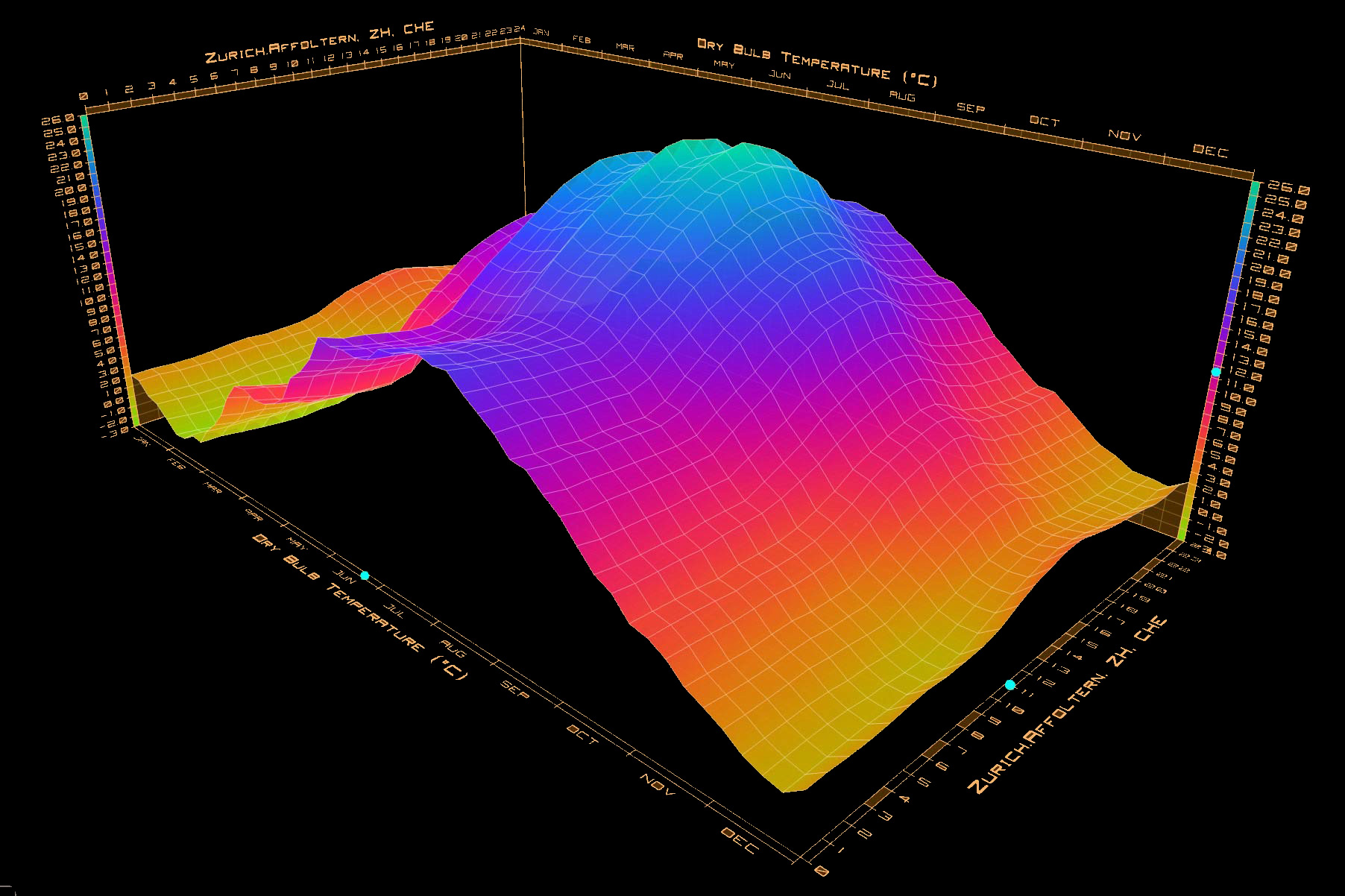
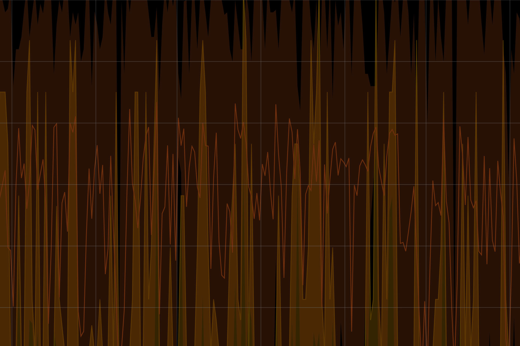
    • The lowest recorded temperature is -6.1°C, registered in December, while the highest is 34.6°C, recorded in August. Temperatures drop below 0°C only on a few days during winter, while the rest of the year remains relatively mild. With climate change, the need for cooling is becoming increasingly important and will play a larger role in future building designs.

      Relative humidity mostly ranges from 60% to 100%, with exceptions such as a few days in March when it dropped below 40%. These variations can affect indoor comfort and influence energy demand for humidification or dehumidification.

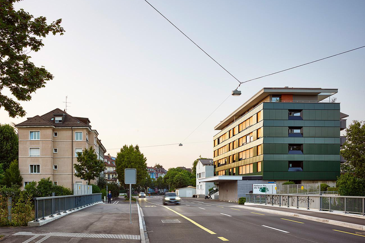
      The third graph combines three types of solar radiation data: global horizontal, direct, and diffuse horizontal. Visualizing these together provides a deeper understanding of solar exposure. In this case, the building site at MFH Oberwilerstrasse receives consistent solar radiation throughout the year, which benefits passive solar design and energy generation.

      Wind data includes both direction and speed. The prevailing wind comes primarily from the northwest, with relatively low speeds, peaking at around 7 m/s. This suggests wind is not a major concern for structural loads but may influence natural ventilation strategies.

      Finally, precipitation is unevenly distributed throughout the year, with the highest amounts occurring during summer. Comparing the precipitation and temperature graphs shows that the wettest periods coincide with the warmest months, which may impact drainage design and water management on-site.

      By combining the temperature and relative humidity graphs, an inverse pattern becomes clear: during the colder months in Basel, relative humidity tends to be higher. In contrast, in the warmer months, when temperatures reach their peak, relative humidity typically decreases.

    • Can we use the facade to harvest solar energy?

      Tool: Geo Admin,GIS Browser - Cantons Collection

      Understanding the climate at Oberwilerstrasse provides a clear picture of how the environment behaves throughout the year: how warm it gets, when sunlight is available, and how the wind moves across the site. This knowledge is essential for planning passive design strategies, such as using solar gain to heat rooms or orienting windows for natural ventilation.

      With this foundation, the next step is to explore the site’s specific energy potential: what local renewable resources can be harnessed effectively?

      To answer this, we analyzed the site’s renewable energy potentials using GIS tools from the Swiss Confederation, examining detailed maps of solar, biomass, wind, and groundwater resources.

      The results were clear. Solar energy emerged as the most reliable and promising resource, thanks to consistent sunlight at Oberwilerstrasse. Biomass offered some potential for supplemental heating, while wind and groundwater proved limited and less dependable.

      Armed with these insights, the architects made a decisive choice: to design MFH Oberwilerstrasse around its solar potential, transforming a natural advantage into a cornerstone of sustainable design.

    • The four maps represent the solar, biomass, wind, and groundwater potential at the site. Source: Geo Admin

    • How can we turn the sun’s potential into energy?

      Tool: Hive, Ladybug

      Looking closely at the solar potential, the roof of the MFH Oberwilerstrasse is marked in orange, indicating good potential, while the façades are marked in blue, showing low potential.

      This raises an interesting question: why does the city-facing façade, rated as having low potential, feature dark green photovoltaic panels in the completed project?

      This example highlights the limitations of the mapping tool. Its analysis is primarily based on building orientation and shading, without taking into account important factors such as differences between individual floors.

      For a more precise evaluation especially at the floor by floor level, more advanced tools such as Hive or Ladybug should be used.

    • Photo: Salathé Architekten Basel / Roman Weyeneth

    • Do you have questions or comments?

      If you have questions about the climate and potential analysis, the MFH Oberwilerstrasse project, or if you'd like to share your experiences, ideas, or reflections on how these topics relate to a real-world project or a tool you've used, feel free to join the discussion in the forum.

This is a non-production site